Provincial Highway 7 (Taiwan) on:
[Wikipedia]
[Google]
[Amazon]
Provincial Highway 7 () is a highway connecting Daxi, Taoyuan and Zhuangwei, Yilan. The highway is also known as Northern Cross-Country Highway (), one of the three most important east–west highways in Taiwan.


Route description
The highway begins at the junction ofHighway 3
The following highways are numbered 3, H-3, PRI-3, AH3, E03 and R3. For roads numbered A3, see A3 roads. For roads numbered M3, see M3. For roads numbered N3, see N3. For roads numbered 3A, see 3A.
International
* Asian Highway 3
* Europea ...
in Daxi. The route then passes through Cihu Mausoleum
Cihu Mausoleum (), officially known as the Mausoleum of Late President Chiang () or President Chiang Kai-shek Mausoleum, is the final resting place of President Chiang Kai-shek. It is located in Daxi District, Taoyuan City, Taiwan. When Chiang Ka ...
, the tombs of the late presidents Chiang Kai-shek and Chiang Ching-Kuo
Chiang Ching-kuo (27 April 1910 – 13 January 1988) was a politician of the Republic of China after its retreat to Taiwan. The eldest and only biological son of former president Chiang Kai-shek, he held numerous posts in the government ...
. After the intersection with Highway 7B, the route enters the aboriginal district of Fuxing in Taoyuan City
Taoyuan () is a special municipality of the Republic of China (Taiwan) located in northwestern Taiwan, neighboring New Taipei City to the north-east, Yilan County to the south-east, and Hsinchu County to the south-west. Taoyuan Distr ...
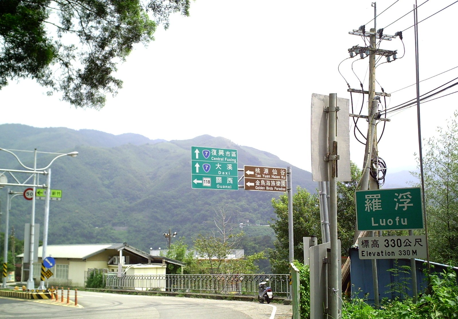
. At Luofu village (羅浮, Rahao) in Fuxing, the highway passes through the intersection with County Road 118, a popular scenic route also known as LuoMa Highway (羅馬公路).
Starting from Fuxing, the road becomes a narrow and winding 1-lane highway as it crosses the Central Mountain Range
The Central Mountain Range is the principal mountain range on the island of Taiwan. It runs from the north of the island to the south. Due to this separation, connecting between the west and east is not very convenient. The tallest peak of th ...
. The highway passes through numerous tribal villages along the way. The highway then enters Datong, Yilan
Datong Township () is a mountain indigenous township in the southwestern part of Yilan County, Taiwan. It is the second largest township in Yilan County after Nan'ao Township.
Geography
It is predominantly populated by Taiwanese aborigines o ...
, which is also an aboriginal township. At Datong, the highway passes through Mingchi Forest Recreational Area (明池國家森林遊樂區) and Qilan Forest Recreational Area (棲蘭國家森林遊樂區). The highway has a junction with Highway 7a in the Qilan area and another with Highway 7c near Yingshi village (英士村), both located in Datong. The highway then follows the Lanyang River
The Lanyang River () is a river in northeast Taiwan.
Geology
The river flows through Yilan County for 73 kilometers. It has a drainage basin area of 978 km2 with maximum peak flow of 5,420 m3/s.
See also
*List of rivers in Taiwan
This is ...
and continues to Yuanshan, Yilan
Yuanshan Township () is a rural township in the western part of Yilan County, Taiwan.
Geography
* Area:
* Population: 32,377 (2014)
Administrative divisions
The township comprises 16 villages:
* Hubei (湖北村), Huihao (惠好村), Hudong/ ...
and Yilan City
Yilan City ( Mandarin pinyin: ''Yílán Shì''; Hokkien POJ: ''Gî-lân-chhī'') is a county-administered city and the county seat of Yilan County, Taiwan Province, Republic of China. The city lies on the north side of the Lanyang River.
H ...
. At Yilan City, the highway intersects with PH 9 and Freeway 5 before ending at PH 2 in Zhuangwei. At some points (such as in Sileng (roughly at the 58-59km mark)) the road has an elevation of 1170 meters.
Spur routes
* The highway runs from its parent route at Qilan inDatong, Yilan
Datong Township () is a mountain indigenous township in the southwestern part of Yilan County, Taiwan. It is the second largest township in Yilan County after Nan'ao Township.
Geography
It is predominantly populated by Taiwanese aborigines o ...
to PH 8 at Lishan (梨山) in Heping District. It is also known as the Yilan branch of the Central Cross-Island Highway (中橫公路宜蘭支線). The total length is 73.988 km.
* The highway runs from PH 3 in Sanxia, New Taipei City to its parent route in Fuxing District. It was assigned as a part of Highway 7 until the segment between Daxi and Fuxing opened. The total length is 14.15 km.
* The highway runs from its parent route in Datong, Yilan to Highway 2e in Wujie, Yilan, passing through Sanxing, Yilan
Sanxing Township (), also spelled Sanshing Township, is a rural township in the western part of Yilan County, Taiwan.
Geography
It has an area of 144.22 km2 and estimate population of 21, 503 people as of 2014.
Administrative divisions
Th ...
, Dongshan, Yilan
Dongshan Township () is a rural township in the central part of Yilan County, Taiwan.
Geography
* Area: 79.86 km2
* Population: 53,482 people (December 2014)
Administrative divisions
Zhenzhu, Bucheng, Sanji, Daxing, Tungcheng, Xianghe, ...
, and Luodong, Yilan. The highway links the township in central Yilan plains to the cross-island highway. The total length is 31.337 km.
* The highway runs from Yuanshan, Yilan
Yuanshan Township () is a rural township in the western part of Yilan County, Taiwan.
Geography
* Area:
* Population: 32,377 (2014)
Administrative divisions
The township comprises 16 villages:
* Hubei (湖北村), Huihao (惠好村), Hudong/ ...
to Yilan City. It was originally planned to extend to Wulai, New Taipei City but was not built. The total length is 16.153 km.
References
External links
* http://www.thb.gov.tw/ Directorate General of Highways, MOTC, Taiwan {{Taiwan Provincial Highways Highways in Taiwan